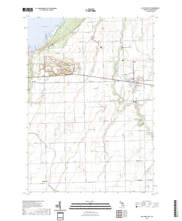
2023 Map of Bay Port East
USGS Topo · Published 2023About this map
Wild Fowl Bay defines the northwestern reaches of this Huron County landscape, where the shoreline meets a structured grid of agricultural roads and drainage systems. The Pigeon River meanders across the eastern half of the sheet, anchoring the larger settlement of Pigeon and the nearby village of Berne. This area is particularly rich in genealogical data, preserving the locations of numerous denominational burial grounds including Saint Johns Lutheran Cem and Pigeon River Mennonite Cem, which reflect the area's religious and ethnic heritage. Farther south, the small communities of Linkville and Kilmangh sit among the headwaters of Shebeon Creek and Mud Creek. The map documents a deeply established farming region where the transport of goods and access to the bay have shaped the local economy and settlement patterns for generations.
Find a feature on this map
64 named features on this map. Tap any name to fly to it.
Don’t see what you’re looking for? This feature index may not catch every label — zoom into the map to look around manually.
Map Details
Editions of this 2023 Bay Port East Map
This is the sole edition of this map. No revisions or reprints were ever made.
Other maps of this area

1954 · Flint
USGS Topo · 1:250,000

1958 · Flint
USGS Topo · 1:250,000

1963 · Gagetown
USGS Topo · 1:24,000

1963 · Owendale
USGS Topo · 1:24,000

1963 · Sebewaing
USGS Topo · 1:24,000

1970 · Bay Port West
USGS Topo · 1:24,000

1970 · Bay Port East
USGS Topo · 1:24,000

1970 · Caseville
USGS Topo · 1:24,000
1970 · Rush Lake
USGS Topo · 1:24,000

1970 · Sand Point
USGS Topo · 1:24,000