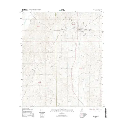
2015 Map of Bay Springs
USGS Topo · Published 2015About this map
Bay Springs serves as the focal point of this 2015 study, situated at the boundary of Smith and Jasper counties. The landscape is defined by a dense network of watercourses, including West Tallahala Creek in the northwest and the winding paths of Etehomo Cr and Roaring Cr. This modern survey illustrates the persistent importance of timber and industry in the region, evidenced by landmarks like Georgia-Pacific Rd.
Find a feature on this map
94 named features on this map. Tap any name to fly to it.
Don’t see what you’re looking for? This feature index may not catch every label — zoom into the map to look around manually.
Map Details
Editions of this 2015 Bay Springs Map
This is the sole edition of this map. No revisions or reprints were ever made.
Other maps of this area

1953 · Hattiesburg
USGS Topo · 1:250,000

1953 · Meridian
USGS Topo · 1:250,000

1957 · Meridian
USGS Topo · 1:250,000

1958 · Hattiesburg
USGS Topo · 1:250,000

1964 · Moss
USGS Topo · 1:24,000

1964 · Lake Como
USGS Topo · 1:24,000

1965 · Meridian
USGS Topo · 1:250,000

1968 · Louin
USGS Topo · 1:24,000

1968 · Louin SW
USGS Topo · 1:24,000
1970 · Montrose South
USGS Topo · 1:24,000