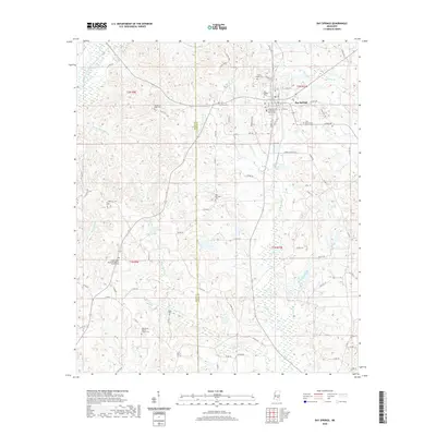
2020 Map of Bay Springs
USGS Topo · Published 2020About this map
Bay Springs serves as the focal point of this Mississippi landscape, dominated by the Jasper County Courthouse. The town is situated among the headwaters of numerous small waterways, including Tallabala Creek and Etehomo Creek, which drain the undulating terrain of the Pine Belt. The map reveals a high density of rural religious and burial sites that are essential for genealogical research, such as the Shady Grove Missionary Baptist Church/Cem and Old Mount Nebo Cem.
Find a feature on this map
89 named features on this map. Tap any name to fly to it.
Don’t see what you’re looking for? This feature index may not catch every label — zoom into the map to look around manually.
Map Details
Editions of this 2020 Bay Springs Map
This is the sole edition of this map. No revisions or reprints were ever made.
Other maps of this area

1953 · Hattiesburg
USGS Topo · 1:250,000

1953 · Meridian
USGS Topo · 1:250,000

1957 · Meridian
USGS Topo · 1:250,000

1958 · Hattiesburg
USGS Topo · 1:250,000

1964 · Moss
USGS Topo · 1:24,000

1964 · Lake Como
USGS Topo · 1:24,000

1965 · Meridian
USGS Topo · 1:250,000

1968 · Louin
USGS Topo · 1:24,000

1968 · Louin SW
USGS Topo · 1:24,000
1970 · Montrose South
USGS Topo · 1:24,000