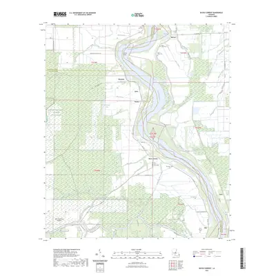
2023 Map of Bayou Current
USGS Topo · Published 2023About this map
Atchafalaya River dominates this landscape where the boundaries of Avoyelles, Pointe Coupee, and St. Landry Parishes meet. The settlement patterns follow the high ground along the winding riverbanks and the many bayous that snake through the West Atchafalaya Floodway. Small communities like Woodside, Bayou Current, and McCrea are connected by a network of local roads including La 105 and Coon Rd.
Find a feature on this map
71 named features on this map. Tap any name to fly to it.
Don’t see what you’re looking for? This feature index may not catch every label — zoom into the map to look around manually.
Map Details
Editions of this 2023 Bayou Current Map
This is the sole edition of this map. No revisions or reprints were ever made.
Other maps of this area

1939 · Fordoche
USGS Topo · 1:62,500

1941 · Batchelor
USGS Topo · 1:62,500

1954 · Baton Rouge
USGS Topo · 1:250,000

1955 · Fordoche
USGS Topo · 1:62,500

1955 · Batchelor
USGS Topo · 1:62,500

1955 · Odenburg
USGS Topo · 1:62,500

1956 · Baton Rouge
USGS Topo · 1:250,000

1959 · Fordoche
USGS Topo · 1:62,500

1959 · Palmetto
USGS Topo · 1:62,500

1961 · Baton Rouge
USGS Topo · 1:250,000