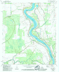
1969 Map of Bayou Current
USGS Topo · Published 1994About this map
The Atchafalaya River dominates this Louisiana landscape, its winding course hemmed in by an extensive Levee system that defines the local geography. This survey documents the area's intricate hydrologic network, where Starks Bayou, Middle Bayou, and Johnson Bayou crisscross the lowlands between the main river and the massive West Atchafalaya Floodway. The settlement pattern follows the high ground near the water, with small communities like Bayou Current, Woodside, and Neita clustered along the river's eastern and western banks.
Find a feature on this map
60 named features on this map. Tap any name to fly to it.
Don’t see what you’re looking for? This feature index may not catch every label — zoom into the map to look around manually.
Map Details
Editions of this 1969 Bayou Current Map
2 editions found
Other maps of this area

1939 · Fordoche
USGS Topo · 1:62,500

1941 · Batchelor
USGS Topo · 1:62,500

1954 · Baton Rouge
USGS Topo · 1:250,000

1955 · Fordoche
USGS Topo · 1:62,500

1955 · Batchelor
USGS Topo · 1:62,500

1955 · Odenburg
USGS Topo · 1:62,500

1956 · Baton Rouge
USGS Topo · 1:250,000

1959 · Fordoche
USGS Topo · 1:62,500

1959 · Palmetto
USGS Topo · 1:62,500

1961 · Baton Rouge
USGS Topo · 1:250,000