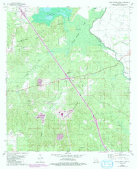
1980 Map of Bayou Pierre Lake
USGS Topo · Published 1992About this map
Naborton and the surrounding De Soto Parish landscape are defined by the presence of the Red River Bull Bayou Gas and Oil Field, where numerous gas wells and gravel pits mark a terrain shaped by industrial extraction. The map reveals a deeply rooted community structure, evidenced by several country churches and family burial grounds including Bethlehem Cem, Woodvine Cem, and the notable Rock Chapel near Carmel. A complex network of waterways, such as Bayou Pierre Lake and its namesake bayou, meanders through the wetlands, separating the higher ground of Paps Hill from the low-lying Chicot Island. 1992 revisions shown in purple highlight new developments and infrastructure near the central Substation, capturing the late-century transition as the region's resource-based economy and transportation routes continued to evolve.
Find a feature on this map
43 named features on this map. Tap any name to fly to it.
Don’t see what you’re looking for? This feature index may not catch every label — zoom into the map to look around manually.
Map Details
Editions of this 1980 Bayou Pierre Lake Map
2 editions found
Other maps of this area

1938 · Chemard Lake
USGS Topo · 1:31,680

1941 · East Point
USGS Topo · 1:31,680

1941 · Pelican
USGS Topo · 1:62,500

1943 · Pleasant Hill
USGS Topo · 1:62,500

1944 · Pleasant Hill
USGS Topo · 1:62,500

1945 · Mansfield
USGS Topo · 1:62,500

1947 · Mansfield
USGS Topo · 1:62,500

1947 · Hanna
USGS Topo · 1:62,500

1948 · Coushatta
USGS Topo · 1:62,500

1953 · Alexandria
USGS Topo · 1:250,000