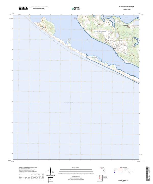
2025 Map of Beacon Beach
USGS Topo · Published 2025About this map
Tyndall Air Force Base occupies a dominant position on this coastal peninsula, where specialized military infrastructure meets the barrier island environment of the Florida Panhandle. The base layout is defined by tactical roadway names like Raptor Cir, Eagle Dr, and Prime Beef Rd, reflecting its active defense role. Beyond the airfield and housing complexes, the landscape transitions into the delicate coastal ecology of Saint Andrew Bay and East Bay, separated from the Gulf of America by the elongated reach of Shell Island. Historic footprints remain visible through the presence of Marywood Cem and the settlement of Cromanton, while the Florida Circumnavigational Paddling Trl skirts the southern shoreline. This intersection of military utility and maritime geography highlights the strategic importance of points like Lands End and Spanish Shanty Point in modern coastal management.
Find a feature on this map
29 named features on this map. Tap any name to fly to it.
Don’t see what you’re looking for? This feature index may not catch every label — zoom into the map to look around manually.
Map Details
Editions of this 2025 Beacon Beach Map
This is the sole edition of this map. No revisions or reprints were ever made.
Other maps of this area

1943 · Beacon Beach
USGS Topo · 1:31,680

1943 · Panama City
USGS Topo · 1:31,680

1943 · Crooked Island
USGS Topo · 1:31,680

1943 · Panama City Beach
USGS Topo · 1:31,680

1944 · Long Point
USGS Topo · 1:31,680
1945 · Parker
USGS Topo · 1:31,680

1949 · Apalachicola
USGS Topo · 1:250,000

1954 · Tallahassee
USGS Topo · 1:250,000
1955 · Panama City Beach
USGS Topo · 1:24,000
1956 · Long Point
USGS Topo · 1:24,000
Featured Places
- Beacon Beach, FL
- Felix Lake, FL
- Redfish Point Extension, FL
- Redfish Point Housing, FL
- Sabre Palms Housing, FL