
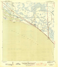
1944 Map of Beacon Hill
USGS Topo · Published 1944About this map
St Andrews Sound and the barrier dunes of the Florida Panhandle coastline define this wartime landscape, surveyed just as the regional infrastructure was adapting to mid-century growth. The map documents the coastal corridor where the Bay Co Gulf Co boundary meets the shoreline at Beacon Hill, a settlement positioned at the high ground overlooking St Joseph Bay. This 1943 survey captures the interplay between maritime features and the interior Swamp, where small family-named water bodies like Joe Lamb Branch and Preacher Bryant Ponds suggest the presence of long-established local holdings. The newly developed Intracoastal Waterway cuts through the northern marshlands, marking a significant era in Southern coastal navigation and commerce near Farmdale and the narrow inlet at Wild Goose Lagoon.
Find a feature on this map
16 named features on this map. Tap any name to fly to it.
Don’t see what you’re looking for? This feature index may not catch every label — zoom into the map to look around manually.
Map Details
Editions of this 1944 Beacon Hill Map
3 editions found
Other maps of this area

1943 · Port St. Joe
USGS Topo · 1:31,680

1943 · Overstreet
USGS Topo · 1:31,680

1943 · Crooked Island
USGS Topo · 1:31,680

1944 · Long Point
USGS Topo · 1:31,680

1945 · Allanton
USGS Topo · 1:31,680

1945 · Wetappo Creek
USGS Topo · 1:31,680

1945 · St Joseph Point
USGS Topo · 1:31,680

1947 · Allanton
USGS Topo · 1:25,000

1949 · Apalachicola
USGS Topo · 1:250,000

1954 · Tallahassee
USGS Topo · 1:250,000