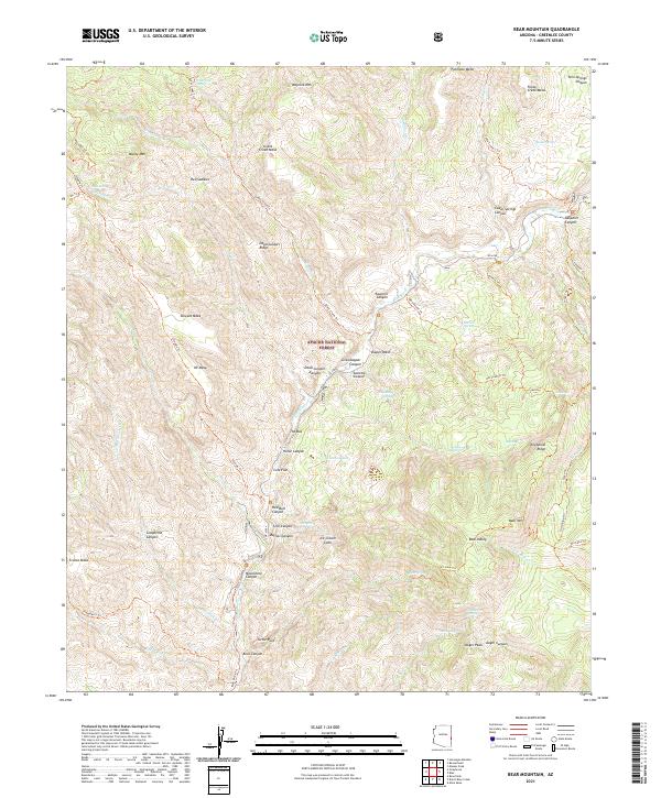
2021 Map of Bear Mountain
USGS Topo · Published 2021About this map
The Blue River winds through a complex network of canyons and high mesas within the Apache National Forest in this 2021 topographic record. This portion of Greenlee County is defined by a rugged drainage system where Grant Creek and Little Blue Creek join the main river corridor. The landscape is marked by distinctive geological features like the Ice Cream Cone and Turtle Rock, alongside expansive plateaus such as Fishhook Mesa and Grant Creek Mesa.
Find a feature on this map
87 named features on this map. Tap any name to fly to it.
Don’t see what you’re looking for? This feature index may not catch every label — zoom into the map to look around manually.
Map Details
Editions of this 2021 Bear Mountain Map
This is the sole edition of this map. No revisions or reprints were ever made.
Other maps of this area

1913 · Morenci
USGS Topo · 1:125,000

1915 · Morenci
USGS Topo · 1:125,000

1922 · Nutrioso
USGS Topo · 1:125,000

1954 · Clifton
USGS Topo · 1:250,000

1957 · Clifton
USGS Topo · 1:250,000

1958 · Clifton
USGS Topo · 1:250,000

1958 · Hannagan Meadow
USGS Topo · 1:62,500

1961 · Blue
USGS Topo · 1:62,500

1962 · Clifton
USGS Topo · 1:250,000
1967 · Alma Mesa
USGS Topo · 1:24,000