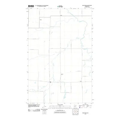
2010 Map of Bear River
USGS Topo · Published 2010About this map
Bear River and Celina sit at the heart of this Northwoods landscape, where a complex network of waterways defines the terrain. The area is dominated by the winding path of the Sturgeon River and its various tributaries, including Stony Brook, Sand Creek, and Bear River Creek. This hydrology, combined with the presence of Anderson Airport, suggests a region where traditional northern settlement patterns meet modern transportation needs.
Find a feature on this map
29 named features on this map. Tap any name to fly to it.
Don’t see what you’re looking for? This feature index may not catch every label — zoom into the map to look around manually.
Map Details
Editions of this 2010 Bear River Map
This is the sole edition of this map. No revisions or reprints were ever made.
Other maps of this area

1954 · Hibbing
USGS Topo · 1:250,000

1955 · Dewey Lake NW
USGS Topo · 1:24,000

1957 · Hibbing
USGS Topo · 1:250,000

1958 · Hibbing
USGS Topo · 1:250,000

1964 · Hibbing
USGS Topo · 1:250,000

1964 · Side Lake
USGS Topo · 1:24,000

1964 · Gheen NW
USGS Topo · 1:24,000
1964 · Meadow Brook
USGS Topo · 1:24,000

1964 · Sherry Lake
USGS Topo · 1:24,000

1970 · Rauch
USGS Topo · 1:24,000