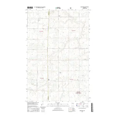
2016 Map of Bear River
USGS Topo · Published 2016About this map
Bear River and Celina sit along the border of Itasca and St. Louis Counties in a landscape defined by the winding paths of the Sturgeon River and Bear River. This 2016 survey documents the rural character of the region, where family and community landmarks like Carpenter Cemetery and Morcom Cemetery are situated among the forest and wetlands. The southern reaches of the map include a portion of the Superior National Forest, contrasting with the localized aviation history at Anderson Airport. A dense network of rural routes, including County Highway 5 and Lake Road, connects these small settlements across the undulating terrain. The hydrology is particularly prominent, with the Stony Brook and Bear River Creek drainage systems shaping the land use and township boundaries in this part of northern Minnesota.
Find a feature on this map
36 named features on this map. Tap any name to fly to it.
Don’t see what you’re looking for? This feature index may not catch every label — zoom into the map to look around manually.
Map Details
Editions of this 2016 Bear River Map
This is the sole edition of this map. No revisions or reprints were ever made.
Other maps of this area

1954 · Hibbing
USGS Topo · 1:250,000

1955 · Dewey Lake NW
USGS Topo · 1:24,000

1957 · Hibbing
USGS Topo · 1:250,000

1958 · Hibbing
USGS Topo · 1:250,000

1964 · Hibbing
USGS Topo · 1:250,000

1964 · Side Lake
USGS Topo · 1:24,000

1964 · Gheen NW
USGS Topo · 1:24,000
1964 · Meadow Brook
USGS Topo · 1:24,000

1964 · Sherry Lake
USGS Topo · 1:24,000

1970 · Rauch
USGS Topo · 1:24,000