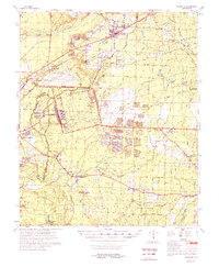
1978 Map of Bearden
USGS Topo · Published 1978About this map
The St Louis and Southwestern Railroad corridor anchors the settlement of Bearden, serving as a focal point for timber and industrial development in late-1970s South Arkansas. This 1978 composite survey reveals a landscape of transition where rural hamlets like Eagle Mills and Millville dot the creeks of Ouachita and Calhoun Counties. The southwestern portion of the map is dominated by institutional footprints, including the Abandoned Ammunition Depot and educational facilities such as the Southwest Technical Institute and the State Police Academy.
Find a feature on this map
76 named features on this map. Tap any name to fly to it.
Don’t see what you’re looking for? This feature index may not catch every label — zoom into the map to look around manually.
Map Details
Editions of this 1978 Bearden Map
This is the sole edition of this map. No revisions or reprints were ever made.
Other maps of this area

1903 · Camden
USGS Topo · 1:125,000

1934 · Moro Bay
USGS Topo · 1:62,500

1938 · Moro Bay
USGS Topo · 1:62,500

1939 · Moro Bay
USGS Topo · 1:62,500

1951 · Camden
USGS Topo · 1:24,000

1953 · El Dorado
USGS Topo · 1:250,000

1957 · El Dorado
USGS Topo · 1:250,000

1958 · El Dorado
USGS Topo · 1:250,000

1960 · El Dorado
USGS Topo · 1:250,000

1962 · Louann
USGS Topo · 1:24,000