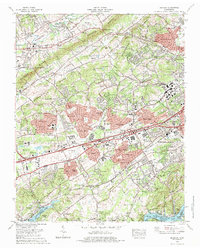
1978 Map of Bearden
USGS Topo · Published 1979About this map
Beaver Ridge and Blackoak Ridge dictate the structural landscape of Knox County, framing the fertile Hines Valley and Beaver Valley. During the late 1970s, this area northwest of Knoxville shows significant residential expansion, with developments like Crestwood Hills and Middlebrook Acres filling the spaces between established ridges. The land remains anchored by institutional landmarks such as the Zion Childrens Home and the Springfield Home, reflecting a long-standing community infrastructure.
Find a feature on this map
127 named features on this map. Tap any name to fly to it.
Don’t see what you’re looking for? This feature index may not catch every label — zoom into the map to look around manually.
Map Details
Editions of this 1978 Bearden Map
4 editions found
Other maps of this area

1886 · Knoxville
USGS Topo · 1:125,000

1892 · Knoxville
USGS Topo · 1:125,000

1893 · Briceville
USGS Topo · 1:125,000

1894 · Knoxville
USGS Topo · 1:125,000

1895 · Loudon
USGS Topo · 1:125,000

1895 · Briceville
USGS Topo · 1:125,000

1895 · Knoxville
USGS Topo · 1:125,000

1896 · Briceville
USGS Topo · 1:125,000

1897 · Maynardville
USGS Topo · 1:125,000

1900 · Maynardville
USGS Topo · 1:125,000