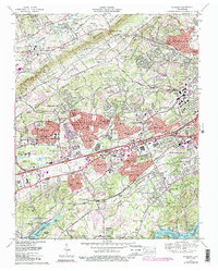
1978 Map of Bearden
USGS Topo · Published 1990About this map
Beaver Ridge and Blackoak Ridge define the parallel valleys of West Knoxville during a period of rapid suburban expansion. The 1978 data, updated with late-1980s urban extents, shows the transition of rural communities like Byington and Karns into the sprawling residential corridors of Cedar Bluff and West Hills. This era of growth is anchored by major commercial and medical hubs, including the West Town Mall and Park West Hospital, which transformed the landscape north of Fort Loudoun Lake.
Find a feature on this map
133 named features on this map. Tap any name to fly to it.
Don’t see what you’re looking for? This feature index may not catch every label — zoom into the map to look around manually.
Map Details
Editions of this 1978 Bearden Map
4 editions found
Other maps of this area

1886 · Knoxville
USGS Topo · 1:125,000

1892 · Knoxville
USGS Topo · 1:125,000

1893 · Briceville
USGS Topo · 1:125,000

1894 · Knoxville
USGS Topo · 1:125,000

1895 · Loudon
USGS Topo · 1:125,000

1895 · Briceville
USGS Topo · 1:125,000

1895 · Knoxville
USGS Topo · 1:125,000

1896 · Briceville
USGS Topo · 1:125,000

1897 · Maynardville
USGS Topo · 1:125,000

1900 · Maynardville
USGS Topo · 1:125,000