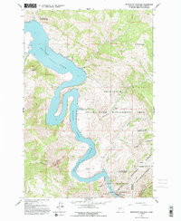
1962 Map of Beartooth Mountain
USGS Topo · Published 1993About this map
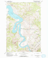
Holter Lake dominates this rugged portion of the Missouri River corridor north of Helena, where the water carves through the dramatic limestone cliffs of the Gates of the Rocky Mountains. This 1962 field check documents a landscape defined by protected wilderness and remote access points, including the Oxbow Landing Strip and Ming Bar Landing Strip. The presence of the State Game Management Area and the Gates of the Mountains Wilderness illustrates a mid-century commitment to preserving the corridor's primitive character. Local habitation is sparse, centered on sites like Beartooth Ranch and the Indian Trail Lodge, while the river itself winds through the sharp Oxbow Bend before entering the narrow Meriwether Canyon. The map preserves the transition from managed state lands to the wilder reaches of the Helena National Forest.
Find a feature on this map
28 named features on this map. Tap any name to fly to it.
Don’t see what you’re looking for? This feature index may not catch every label — zoom into the map to look around manually.
Map Details
Editions of this 1962 Beartooth Mountain Map
5 editions found
Other maps of this area

1886 · Great Falls
USGS Topo · 1:250,000

1886 · Fort Logan
USGS Topo · 1:250,000

1889 · Helena
USGS Topo · 1:250,000

1893 · Helena
USGS Topo · 1:250,000

1899 · Helena
USGS Topo · 1:250,000

1903 · Helena
USGS Topo · 1:250,000

1943 · Hogan
USGS Topo · 1:125,000

1947 · Butte
USGS Topo · 1:250,000

1948 · White Sulphur Springs
USGS Topo · 1:250,000

1954 · Great Falls
USGS Topo · 1:250,000