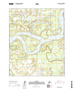
2017 Map of Beaver A-3 NW
USGS Topo · Published 2017About this map
The Yukon River dominates this interior Alaska landscape, carving a complex network of channels and islands through the Yukon-Koyukuk region. In this contemporary 2017 survey, the river's dynamic nature is evident through the naming of large landmasses like Moose Island and Kings Slough Island, which are defined by the surrounding water. Beyond the main channel, the map reveals a mosaic of side waters including Kings Slough and the winding Jim Karse Slough. These features, along with Marten Slough, illustrate the intricate hydrological patterns of the northern floodplains. The low-lying terrain is punctuated by significant bodies of water such as Dave Lake and Herman Lake in the north, while the southern reach is drained by Old Lost Creek. This map provides a detailed view of a landscape where seasonal water movement dictate the shape of the land.
Find a feature on this map
16 named features on this map. Tap any name to fly to it.
Don’t see what you’re looking for? This feature index may not catch every label — zoom into the map to look around manually.
Map Details
Editions of this 2017 Beaver A-3 NW Map
This is the sole edition of this map. No revisions or reprints were ever made.
Other maps of this area

1951 · Beaver
USGS Topo · 1:250,000

1956 · Beaver B-3
USGS Topo · 1:63,360

1956 · Beaver A-3
USGS Topo · 1:63,360

1956 · Beaver
USGS Topo · 1:250,000

1956 · Beaver A-4
USGS Topo · 1:63,360

1956 · Beaver B-4
USGS Topo · 1:63,360

1964 · Beaver
USGS Topo · 1:250,000
2017 · Beaver B-3 SW
USGS Topo · 1:25,000
2017 · Beaver A-3 SE
USGS Topo · 1:25,000
2017 · Beaver A-4 SE
USGS Topo · 1:25,000