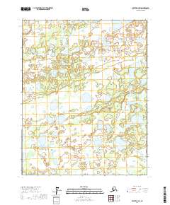
2017 Map of Beaver B-3 SW
USGS Topo · Published 2017About this map
Yukon Flats defines this portion of the interior Alaskan landscape, characterized by a dense network of wetlands and scattered water bodies. The terrain is marked by notable depressions and elevations such as Sand Hill Gap, which provides a geographical focal point amidst the sprawling lowlands. Water is the dominant feature of the region, with Meadow Cr winding through the center of the quadrangle and feeding into larger basins. Significant named bodies of water include Marack Lake, Bullrush Lake, Albert Lake, and Herman Lake, which illustrate the complex hydrology of the Yukon-Koyukuk region. This map serves as a primary reference for the intricate natural drainage patterns of the area, showing how these lakes and creeks interconnect across the townships of t18n r4w and t17n r3w.
Find a feature on this map
11 named features on this map. Tap any name to fly to it.
Don’t see what you’re looking for? This feature index may not catch every label — zoom into the map to look around manually.
Map Details
Editions of this 2017 Beaver B-3 SW Map
This is the sole edition of this map. No revisions or reprints were ever made.
Other maps of this area

1951 · Beaver
USGS Topo · 1:250,000

1956 · Beaver B-3
USGS Topo · 1:63,360

1956 · Beaver A-3
USGS Topo · 1:63,360

1956 · Beaver
USGS Topo · 1:250,000

1956 · Beaver A-4
USGS Topo · 1:63,360

1956 · Beaver B-4
USGS Topo · 1:63,360

1964 · Beaver
USGS Topo · 1:250,000
2017 · Beaver A-3 NW
USGS Topo · 1:25,000
2017 · Beaver B-3 NW
USGS Topo · 1:25,000
2017 · Beaver B-4 NE
USGS Topo · 1:25,000