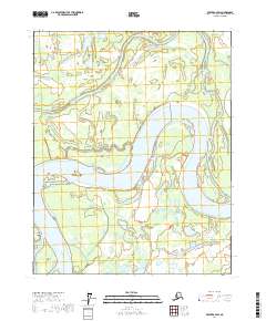
2017 Map of Beaver A-4 SW
USGS Topo · Published 2017About this map
Stevens Village stands as the primary human settlement in this sub-arctic riverine environment, positioned along the banks where the Yukon River meanders through complex braided channels and low-lying islands. The landscape is defined by its water-dominant geography, featuring prominent landforms like Adams Island and Jackson Island that split the heavy flow of the Yukon. Numerous waterways such as Mail Slough and Jackson Slough create a network of seasonal and permanent channels that dictate the movement of both people and wildlife.
Find a feature on this map
14 named features on this map. Tap any name to fly to it.
Don’t see what you’re looking for? This feature index may not catch every label — zoom into the map to look around manually.
Map Details
Editions of this 2017 Beaver A-4 SW Map
This is the sole edition of this map. No revisions or reprints were ever made.
Other maps of this area

1945 · Livengood
USGS Topo · 1:250,000

1951 · Livengood
USGS Topo · 1:250,000

1951 · Beaver
USGS Topo · 1:250,000

1952 · Livengood D-5
USGS Topo · 1:63,360

1953 · Livengood D-4
USGS Topo · 1:63,360

1954 · Livengood D-4
USGS Topo · 1:63,360

1956 · Beaver A-5
USGS Topo · 1:63,360

1956 · Beaver
USGS Topo · 1:250,000

1956 · Beaver A-4
USGS Topo · 1:63,360

1956 · Livengood
USGS Topo · 1:250,000