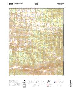
2017 Map of Beaver A-6 SW
USGS Topo · Published 2017About this map
Fort Hamlin Hills dominate the topography of this remote section of the Yukon-Koyukuk Census Area, where the landscape is defined by elevated ridges and drainage networks. The terrain is largely characterized by wetlands and seasonal water flows, including the course of Woodcamp Cr in the southern reaches. This 2017 survey reflects a largely undeveloped wilderness within the Alaska interior, providing a precise look at the township and range divisions of T15N and T14N across Ranges 10W through 12W. The absence of road infrastructure or permanent settlements underscores the isolation of this region between the Brooks Range and the Yukon River basin, making it a critical reference for understanding the physical geography and hydrography of the Alaskan bush.
Find a feature on this map
8 named features on this map. Tap any name to fly to it.
Don’t see what you’re looking for? This feature index may not catch every label — zoom into the map to look around manually.
Map Details
Editions of this 2017 Beaver A-6 SW Map
This is the sole edition of this map. No revisions or reprints were ever made.
Other maps of this area

1945 · Livengood
USGS Topo · 1:250,000

1951 · Bettles
USGS Topo · 1:250,000

1951 · Tanana
USGS Topo · 1:250,000

1951 · Livengood
USGS Topo · 1:250,000

1951 · Beaver
USGS Topo · 1:250,000

1956 · Bettles
USGS Topo · 1:250,000

1956 · Beaver
USGS Topo · 1:250,000

1956 · Livengood D-6
USGS Topo · 1:63,360

1956 · Tanana D-1
USGS Topo · 1:63,360

1956 · Livengood
USGS Topo · 1:250,000