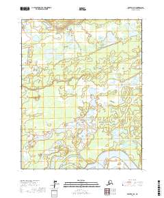
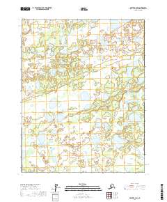
2017 Map of Beaver B-3 SE
USGS Topo · Published 2017About this map
The Yukon River defines the southern boundary of this portion of the Yukon Flats, a region characterized by a complex network of wetlands and namesake water bodies. This 2017 survey details a landscape where water and land are in constant flux, featuring prominent basins such as Cook Lake, Roaring Bear Lake, and the expansive White Fox Lake. The naming conventions found on the map, including Hermit Gulch and Marten Island, reflect the area's deep history of trapping and subsistence living. Higher ground is found at the Sand Hills, providing contrast to the low-lying marshlands and smaller ponds like Ned Pond and Shack Lake. This map serves as a vital document of the intricate hydrography of the northern interior, tracing the relationships between major flows like the Yukon River and its backwater lakes like Lower Horseshoe Lake.
Find a feature on this map
26 named features on this map. Tap any name to fly to it.
Don’t see what you’re looking for? This feature index may not catch every label — zoom into the map to look around manually.
Map Details
Editions of this 2017 Beaver B-3 SE Map
This is the sole edition of this map. No revisions or reprints were ever made.
Other maps of this area

1951 · Beaver
USGS Topo · 1:250,000

1956 · Beaver B-2
USGS Topo · 1:63,360

1956 · Beaver B-3
USGS Topo · 1:63,360

1956 · Beaver A-3
USGS Topo · 1:63,360
1956 · Beaver A-2
USGS Topo · 1:63,360

1956 · Beaver
USGS Topo · 1:250,000

1964 · Beaver
USGS Topo · 1:250,000
2017 · Beaver A-3 NW
USGS Topo · 1:25,000
2017 · Beaver B-3 NW
USGS Topo · 1:25,000
2017 · Beaver B-3 SW
USGS Topo · 1:25,000