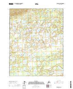
2017 Map of Beaver B-4 SW
USGS Topo · Published 2017About this map
Yukon Flats defines the landscape of this interior Alaska territory, characterized by a dense network of water bodies and wetlands within the t18n r6w and t17n r6w townships. The hydrology of this region is dominated by the meandering E Fork the Forks, which winds through a terrain filled with countless unnamed ponds and smaller lakes. To the south, larger permanent bodies like Tanjoga Lake and Fishnet Lake provide significant landmarks in an otherwise saturated environment. This 2017 survey reflects the remote character of the Yukon-Koyukuk Census Area, showing a complete absence of roads or permanent settlements, where the natural drainage patterns of the flats dictate the geography. The map is a precise record of the complex lacustrine and riverine systems that define this part of the Alaskan wilderness.
Find a feature on this map
8 named features on this map. Tap any name to fly to it.
Don’t see what you’re looking for? This feature index may not catch every label — zoom into the map to look around manually.
Map Details
Editions of this 2017 Beaver B-4 SW Map
This is the sole edition of this map. No revisions or reprints were ever made.
Other maps of this area

1951 · Beaver
USGS Topo · 1:250,000

1956 · Beaver A-5
USGS Topo · 1:63,360

1956 · Beaver B-5
USGS Topo · 1:63,360

1956 · Beaver
USGS Topo · 1:250,000

1956 · Beaver A-4
USGS Topo · 1:63,360

1956 · Beaver B-4
USGS Topo · 1:63,360

1964 · Beaver
USGS Topo · 1:250,000
2017 · Beaver B-5 SE
USGS Topo · 1:25,000
2017 · Beaver A-5 NE
USGS Topo · 1:25,000
2017 · Beaver B-4 NE
USGS Topo · 1:25,000