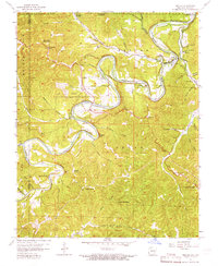
1957 Map of Beaver
USGS Topo · Published 1965About this map
The White River meanders through this portion of the Ozarks, carving a series of dramatic bluffs including Salts Bluff, Poker Bluff, and Wallace Bluff. In the late 1950s, the landscape remained characterized by small hillside settlements and rural institutions, such as Busch and its Busch Ch, alongside the historic spa city of Eureka Springs. A critical transition is noted on the sheet: dashed light-blue patterns indicate the area destined for submergence by Table Rock Reservoir, marking the final years of the original river valley before the dam's completion. Significant landmarks like Inspiration Point and Blue Spring dot the terrain, while the Ozarks and Cherokee Trail follows the high ground. Local genealogy is well-supported by numerous family-named landmarks and small burial grounds, including the Beaver Cem and Fuller Cem.
Find a feature on this map
76 named features on this map. Tap any name to fly to it.
Don’t see what you’re looking for? This feature index may not catch every label — zoom into the map to look around manually.
Map Details
Editions of this 1957 Beaver Map
4 editions found
Other maps of this area

1900 · Eureka Springs
USGS Topo · 1:125,000

1901 · Eureka Springs
USGS Topo · 1:125,000

1927 · Shell Knob
USGS Topo · 1:62,500

1937 · Cassville
USGS Topo · 1:48,000

1944 · Cassville
USGS Topo · 1:62,500

1945 · Harrison
USGS Topo · 1:250,000

1949 · Harrison
USGS Topo · 1:250,000

1950 · Shell Knob
USGS Topo · 1:62,500

1954 · Harrison
USGS Topo · 1:250,000

1957 · Mundell
USGS Topo · 1:24,000