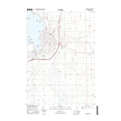
2015 Map of Beaver Dam
USGS Topo · Published 2015About this map
Beaver Dam serves as the focal point of this Dodge County landscape, situated where the Beaver Dam River exits the expansive Beaver Dam Lake. The map reveals a high concentration of religious and memorial sites within the city, including Saint Marys Cem, Saint Michaels Cem, and Saint Patricks Cem. This density of early denominational cemeteries provides significant mapping of the community's ancestral layout.
Find a feature on this map
155 named features on this map. Tap any name to fly to it.
Don’t see what you’re looking for? This feature index may not catch every label — zoom into the map to look around manually.
Map Details
Editions of this 2015 Beaver Dam Map
This is the sole edition of this map. No revisions or reprints were ever made.
Other maps of this area

1955 · Beaver Dam
USGS Topo · 1:62,500

1955 · Waupun
USGS Topo · 1:62,500

1955 · Fox Lake
USGS Topo · 1:62,500

1955 · Horicon
USGS Topo · 1:62,500

1957 · Madison
USGS Topo · 1:250,000

1960 · Madison
USGS Topo · 1:250,000

1975 · Horicon NW
USGS Topo · 1:24,000

1975 · Beaver Dam NE
USGS Topo · 1:24,000
1975 · Waupun SW
USGS Topo · 1:24,000

1980 · Fond Du Lac
USGS Topo · 1:100,000