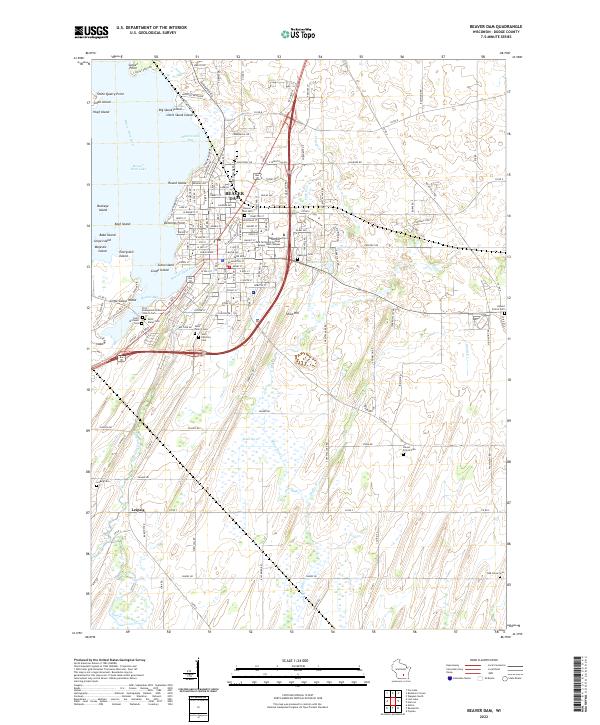
2022 Map of Beaver Dam
USGS Topo · Published 2022About this map
Beaver Dam serves as the focal point of this Dodge County landscape, situated along the southeastern shores of Beaver Dam Lake. The map reveals a highly structured urban core with a dense grid of streets like W Mackie St and Gilmore Ave, transitioning into the academic grounds of the Moraine Park Technical College Beaver Dam Campus. This 2022 survey captures the area's deep-rooted spiritual and local history, evidenced by a remarkable concentration of burial grounds, including the First Evangelical Lutheran Church Cem, Saint Michaels Cem, and Saint Marys Cem.
Find a feature on this map
130 named features on this map. Tap any name to fly to it.
Don’t see what you’re looking for? This feature index may not catch every label — zoom into the map to look around manually.
Map Details
Editions of this 2022 Beaver Dam Map
This is the sole edition of this map. No revisions or reprints were ever made.
Other maps of this area

1955 · Beaver Dam
USGS Topo · 1:62,500

1955 · Waupun
USGS Topo · 1:62,500

1955 · Fox Lake
USGS Topo · 1:62,500

1955 · Horicon
USGS Topo · 1:62,500

1957 · Madison
USGS Topo · 1:250,000

1960 · Madison
USGS Topo · 1:250,000

1975 · Horicon NW
USGS Topo · 1:24,000

1975 · Beaver Dam NE
USGS Topo · 1:24,000
1975 · Waupun SW
USGS Topo · 1:24,000

1980 · Fond Du Lac
USGS Topo · 1:100,000