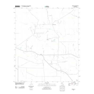
2012 Map of Beaver
USGS Topo · Published 2012About this map
Beaver and Cypress Creek anchor this Louisiana landscape, characterized by an intricate network of waterways and low-lying wetlands. The area is defined by the extensive Bayou Marsh and several winding streams, including Beaver Cr and Cypress Cr, which carve through the terrain. Human presence is marked by a grid of rural roads and aviation points like Dyer Airport and the Leger Landing Strip.
Find a feature on this map
33 named features on this map. Tap any name to fly to it.
Don’t see what you’re looking for? This feature index may not catch every label — zoom into the map to look around manually.
Map Details
Editions of this 2012 Beaver Map
This is the sole edition of this map. No revisions or reprints were ever made.
Other maps of this area

1935 · Beaver
USGS Topo · 1:31,680

1935 · Pawnee
USGS Topo · 1:31,680

1935 · Oakdale
USGS Topo · 1:31,680

1935 · Turkey Creek
USGS Topo · 1:62,500

1942 · Oakdale
USGS Topo · 1:62,500

1947 · Foley
USGS Topo · 1:31,680

1947 · Bond
USGS Topo · 1:31,680

1949 · Glenmora
USGS Topo · 1:31,680

1949 · Turkey Creek
USGS Topo · 1:62,500
1950 · Foley
USGS Topo · 1:31,680