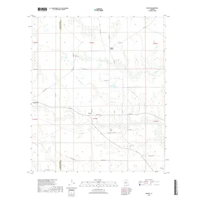
2018 Map of Beaver
USGS Topo · Published 2018About this map
The settlement of Beaver serves as the focal point for this study of the borderlands between Allen Parish and Evangeline Parish. This interior Louisiana landscape is defined by its intricate drainage networks, including the meandering path of Cypress Creek and the expansive Bayou Marsh. The map provides significant detail for genealogists and local historians, documenting several burial sites such as Pecan Grove Cem, Beaver Cem, and Delafosse Cem.
Find a feature on this map
40 named features on this map. Tap any name to fly to it.
Don’t see what you’re looking for? This feature index may not catch every label — zoom into the map to look around manually.
Map Details
Editions of this 2018 Beaver Map
This is the sole edition of this map. No revisions or reprints were ever made.
Other maps of this area

1935 · Beaver
USGS Topo · 1:31,680

1935 · Pawnee
USGS Topo · 1:31,680

1935 · Oakdale
USGS Topo · 1:31,680

1935 · Turkey Creek
USGS Topo · 1:62,500

1942 · Oakdale
USGS Topo · 1:62,500

1947 · Foley
USGS Topo · 1:31,680

1947 · Bond
USGS Topo · 1:31,680

1949 · Glenmora
USGS Topo · 1:31,680

1949 · Turkey Creek
USGS Topo · 1:62,500
1950 · Foley
USGS Topo · 1:31,680