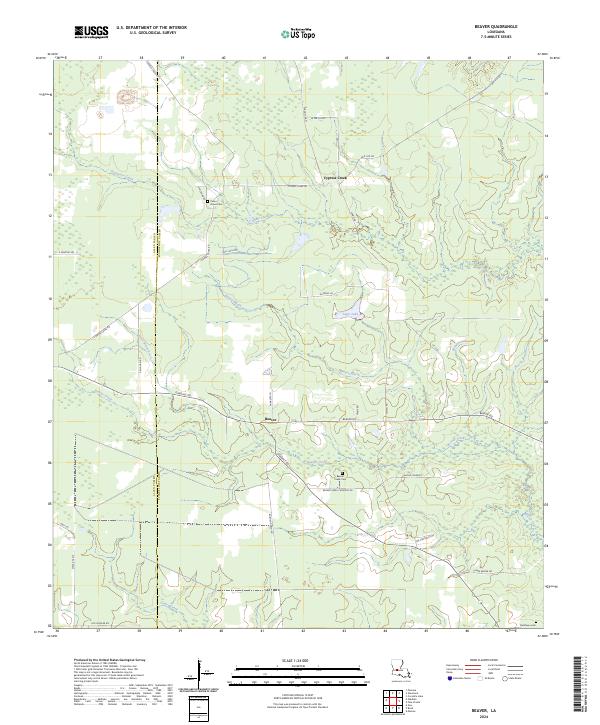
2024 Map of Beaver
USGS Topo · Published 2024About this map
Beaver and the surrounding marshy lowlands of the Allen Parish and Evangeline Parish boundary are defined by a complex network of waterways, including Cypress Creek and the meandering Beaver Creek. The landscape is characterized by its transition from wooded creek bottoms to established local homesteads and small burial grounds like Pecan Grove Cem and Beaver Creek Cem. This 2024 survey illustrates a rural interior where the economy is clearly tied to the land and its drainage, with features such as Bayou Marsh and Leger Lake indicating the low-lying, hydrologically active nature of the region.
Find a feature on this map
42 named features on this map. Tap any name to fly to it.
Don’t see what you’re looking for? This feature index may not catch every label — zoom into the map to look around manually.
Map Details
Editions of this 2024 Beaver Map
This is the sole edition of this map. No revisions or reprints were ever made.
Other maps of this area

1935 · Beaver
USGS Topo · 1:31,680

1935 · Pawnee
USGS Topo · 1:31,680

1935 · Oakdale
USGS Topo · 1:31,680

1935 · Turkey Creek
USGS Topo · 1:62,500

1942 · Oakdale
USGS Topo · 1:62,500

1947 · Foley
USGS Topo · 1:31,680

1947 · Bond
USGS Topo · 1:31,680

1949 · Glenmora
USGS Topo · 1:31,680

1949 · Turkey Creek
USGS Topo · 1:62,500
1950 · Foley
USGS Topo · 1:31,680