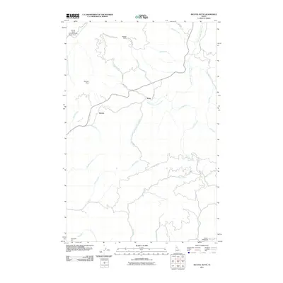
2011 Map of Bechtel Butte
USGS Topo · Published 2011About this map
Emerald Creek Garnet Area and its surrounding mountain drainages define this portion of the Idaho Panhandle. This area is characterized by a dense network of forest roads and trails, such as Natl Forest Develop Road 498 and Bechtel Mountain Rd, which provide access to the timber and mineral resources of the region. The topography is shaped by the headwaters of the Potlatch River and the meandering West Fork Saint Maries River. Small, dispersed settlements like Sherwin and Keeler are situated along these waterways, reflecting a legacy of resource extraction and mountain transit. Named peaks and ridges, including Bechtel Butte and Sherwin Point, overlook a landscape etched by dozens of tributaries such as Keeler Creek and Long Slim Creek. The map documents the persistent use of these forest lands for both industry and recreation in the early 21st century.
Find a feature on this map
39 named features on this map. Tap any name to fly to it.
Don’t see what you’re looking for? This feature index may not catch every label — zoom into the map to look around manually.
Map Details
Editions of this 2011 Bechtel Butte Map
This is the sole edition of this map. No revisions or reprints were ever made.
Other maps of this area

1955 · Pullman
USGS Topo · 1:250,000

1955 · Spokane
USGS Topo · 1:250,000

1958 · Spokane
USGS Topo · 1:250,000

1958 · Pullman
USGS Topo · 1:250,000

1961 · Fernwood
USGS Topo · 1:62,500

1961 · Bovill
USGS Topo · 1:62,500

1969 · Elk River
USGS Topo · 1:24,000

1969 · Anthony Peak
USGS Topo · 1:24,000
1969 · Merry Creek
USGS Topo · 1:24,000

1981 · St Maries
USGS Topo · 1:100,000