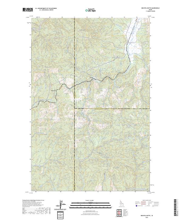
2024 Map of Bechtel Butte
USGS Topo · Published 2024About this map
Keeler and Sherwin stand as the primary reference points in this high-elevation landscape where the boundaries of Shoshone, Latah, and Clearwater counties meet. The terrain is defined by a dense network of drainage systems, most notably the West Fork Saint Maries River and the East Fork Potlatch River, which carve through the timbered highlands. Significant elevations like Bechtel Butte and Sherwin Point dictate the layout of the forest road network, including the Bechtel Mountain Rd and various National Forest Development routes. This survey illustrates the intricate watershed divide where numerous creeks, such as Bechtel Creek and Purdue Creek, originate. The transition from No Name Gulch in the north to Caterpillar Hill in the south highlights a landscape deeply shaped by forestry access and hydraulic patterns.
Find a feature on this map
45 named features on this map. Tap any name to fly to it.
Don’t see what you’re looking for? This feature index may not catch every label — zoom into the map to look around manually.
Map Details
Editions of this 2024 Bechtel Butte Map
This is the sole edition of this map. No revisions or reprints were ever made.
Other maps of this area

1955 · Pullman
USGS Topo · 1:250,000

1955 · Spokane
USGS Topo · 1:250,000

1958 · Spokane
USGS Topo · 1:250,000

1958 · Pullman
USGS Topo · 1:250,000

1961 · Fernwood
USGS Topo · 1:62,500

1961 · Bovill
USGS Topo · 1:62,500

1969 · Elk River
USGS Topo · 1:24,000

1969 · Anthony Peak
USGS Topo · 1:24,000
1969 · Merry Creek
USGS Topo · 1:24,000

1981 · St Maries
USGS Topo · 1:100,000