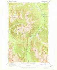
1966 Map of Bedal
USGS Topo · Published 1973About this map
Mt Baker National Forest terrain dominates this 1960s study, where the Mountain Loop Highway winds through the deep river valleys of the Cascade Range. The small settlement at Bedal serves as a central point near the confluence of the North Fork Sauk River and the South Fork, supported by the North Fork Guard Sta and several forest camps. The map documents a recreational and industrial landscape defined by a network of steep routes, including the Sunrise Mine Trail and Dickerman Mtn Trail (Jack Pass), which provide access to high elevation peaks like Mt Forgotten and Lewis Peak. To the south, Monte Cristo Lake and Barlow Pass mark the transition toward the mining districts beyond the map's edge. The distribution of primitive camps such as Mill Camp and Elliott Creek Camp illustrates the era's focus on backcountry management and timber access within Snohomish County.
Find a feature on this map
48 named features on this map. Tap any name to fly to it.
Don’t see what you’re looking for? This feature index may not catch every label — zoom into the map to look around manually.
Map Details
Editions of this 1966 Bedal Map
4 editions found
Other maps of this area

1899 · Glacier Peak
USGS Topo · 1:125,000

1899 · Stillaguamish
USGS Topo · 1:125,000

1901 · Glacier Peak
USGS Topo · 1:125,000

1901 · Stilaguamish
USGS Topo · 1:125,000

1902 · Skykomish
USGS Topo · 1:125,000

1905 · Skykomish
USGS Topo · 1:125,000

1921 · Sultan
USGS Topo · 1:125,000

1923 · Sultan
USGS Topo · 1:125,000

1955 · Concrete
USGS Topo · 1:250,000

1957 · Silverton
USGS Topo · 1:62,500