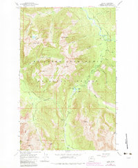
1966 Map of Bedal
USGS Topo · Published 1983About this map
The Sauk River and its multiple forks dominate this mid-century survey of high-elevation Snohomish County, centered on the settlement of Bedal. The landscape is defined by the logistics of the Mount Baker-Snoqualmie National Forest, featuring an extensive network of specialized camps and administrative sites like the North Fork Guard Sta and Mill Camp. The presence of the Mountain Loop Highway and the Palmer Highway suggests a mid-20th-century era of increasing accessibility for both timber management and recreation.
Find a feature on this map
55 named features on this map. Tap any name to fly to it.
Don’t see what you’re looking for? This feature index may not catch every label — zoom into the map to look around manually.
Map Details
Editions of this 1966 Bedal Map
4 editions found
Other maps of this area

1899 · Glacier Peak
USGS Topo · 1:125,000

1899 · Stillaguamish
USGS Topo · 1:125,000

1901 · Glacier Peak
USGS Topo · 1:125,000

1901 · Stilaguamish
USGS Topo · 1:125,000

1902 · Skykomish
USGS Topo · 1:125,000

1905 · Skykomish
USGS Topo · 1:125,000

1921 · Sultan
USGS Topo · 1:125,000

1923 · Sultan
USGS Topo · 1:125,000

1955 · Concrete
USGS Topo · 1:250,000

1957 · Silverton
USGS Topo · 1:62,500