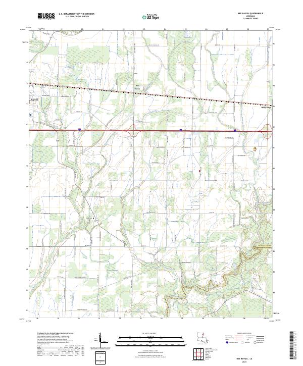
2024 Map of Bee Bayou
USGS Topo · Published 2024About this map
The low-lying wetlands of Bee Bayou dominate this portion of Richland Parish, where a complex network of waterways including Cow Bayou, Burns Bayou, and Cypress Creek meanders through the alluvial landscape. Settlement is concentrated along the east-west corridor between Rayville and Holly Ridge, following the historic path of early transit lines across the northern Louisiana plains. Genealogists will find particular value in the documentation of family-named landmarks and rural burial grounds like Greer Cem and Sunflower Cem, the latter sitting near the boundary where Richland Parish meets Franklin Parish. The map reveals a highly developed grid of parish roads and agricultural spurs, such as Sumun Ranch Rd and Pony Greer Rd, which illustrate the modern management of this productive rural terrain south of the Big Creek drainage.
Find a feature on this map
89 named features on this map. Tap any name to fly to it.
Don’t see what you’re looking for? This feature index may not catch every label — zoom into the map to look around manually.
Map Details
Editions of this 2024 Bee Bayou Map
This is the sole edition of this map. No revisions or reprints were ever made.
Other maps of this area

1935 · Collinston
USGS Topo · 1:62,500

1935 · Alto
USGS Topo · 1:62,500

1935 · Baskinton
USGS Topo · 1:62,500

1935 · Hurricane
USGS Topo · 1:62,500

1955 · Jackson
USGS Topo · 1:250,000

1957 · Mangham
USGS Topo · 1:62,500

1957 · Collinston
USGS Topo · 1:62,500

1958 · Baskinton
USGS Topo · 1:62,500

1958 · Hurricane
USGS Topo · 1:62,500

1961 · Jackson
USGS Topo · 1:250,000