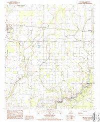
1987 Map of Bee Bayou
USGS Topo · Published 1987About this map
The agricultural landscape of Richland Parish is defined here by a dense network of meandering waterways and the transport corridor of the Illinois Central Gulf railroad. Centered on the settlement of Bee Bayou, the terrain is etched by the intricate paths of Cow Bayou, Hurricane Bayou, and Cypress Creek, which drain the low-lying plains toward the southern boundary. This 1987 provisional survey captures the transition between the eastern edge of Rayville and the community of Holly Ridge during a period when local drainage management—indicated by levees and flumes—was essential for maintaining the surrounding fields. The confluence of several small streams into Big Creek at the Richland Parish and Franklin Parish line illustrates the complex hydrological character of this portion of northern Louisiana.
Find a feature on this map
12 named features on this map. Tap any name to fly to it.
Don’t see what you’re looking for? This feature index may not catch every label — zoom into the map to look around manually.
Map Details
Editions of this 1987 Bee Bayou Map
This is the sole edition of this map. No revisions or reprints were ever made.
Other maps of this area

1935 · Collinston
USGS Topo · 1:62,500

1935 · Alto
USGS Topo · 1:62,500

1935 · Baskinton
USGS Topo · 1:62,500

1935 · Hurricane
USGS Topo · 1:62,500

1955 · Jackson
USGS Topo · 1:250,000

1957 · Mangham
USGS Topo · 1:62,500

1957 · Collinston
USGS Topo · 1:62,500

1958 · Baskinton
USGS Topo · 1:62,500

1958 · Hurricane
USGS Topo · 1:62,500

1961 · Jackson
USGS Topo · 1:250,000