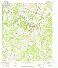
1968 Map of Bee Cave
USGS Topo · Published 1986About this map
Barton Creek and its many tributaries, including Little Barton Creek and Spillman Hollow, carve through the limestone landscape of the Texas Hill Country west of Austin. This late 1960s survey captures the region as it transitioned from traditional ranchlands like Shield Ranch and Panorama Ranch toward modern lakeside development. The emerging community of Lakeway is visible in the northwest, complete with its Landing Strip and Golf Course near Lake Travis.
Find a feature on this map
54 named features on this map. Tap any name to fly to it.
Don’t see what you’re looking for? This feature index may not catch every label — zoom into the map to look around manually.
Map Details
Editions of this 1968 Bee Cave Map
3 editions found
Other maps of this area

1887 · Blanco
USGS Topo · 1:125,000

1894 · Blanco
USGS Topo · 1:125,000

1896 · Austin
USGS Topo · 1:125,000

1897 · Austin
USGS Topo · 1:125,000

1910 · Austin
USGS Topo · 1:125,000

1930 · Austin-2
USGS Topo · 1:48,000

1930 · Blanco-1
USGS Topo · 1:48,000

1932 · Mt. Bonnell
USGS Topo · 1:62,500

1954 · Austin West
USGS Topo · 1:24,000

1954 · Llano
USGS Topo · 1:250,000