
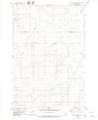
1978 Map of Beebe
USGS Topo · Published 1978About this map
The Chicago Milwaukee St Paul and Pacific railroad forms a straight horizontal axis through the heart of Edmunds County, anchoring the small settlement of Beebe. This late-1970s landscape reflects the systematic township divisions of Huntley, Bryant, Montrelier, and Cleveland, where agricultural utility is etched into the terrain. The topography is defined by numerous prairie potholes and depressions, a characteristic glacial signature that dictates the placement of field lines and roads.
Find a feature on this map
8 named features on this map. Tap any name to fly to it.
Don’t see what you’re looking for? This feature index may not catch every label — zoom into the map to look around manually.
Map Details
Editions of this 1978 Beebe Map
This is the sole edition of this map. No revisions or reprints were ever made.
Other maps of this area

1954 · Aberdeen
USGS Topo · 1:250,000

1956 · Aberdeen
USGS Topo · 1:250,000
1974 · Ipswich SE
USGS Topo · 1:24,000

1974 · Roscoe
USGS Topo · 1:24,000

1978 · Loyalton
USGS Topo · 1:24,000
1978 · Stafford Dam
USGS Topo · 1:24,000
1978 · Ipswich
USGS Topo · 1:24,000

1978 · Hosmer SE
USGS Topo · 1:24,000
1978 · Plainview Colony
USGS Topo · 1:24,000
1978 · Plainview Colony SW
USGS Topo · 1:24,000