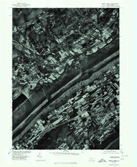
1977 Map of Beech Creek
USGS Topo · Published 1979About this map
Beech Creek serves as the focal point of this 1970s orthophotoquad, which provides a high-altitude perspective on the agricultural and forested landscape of Clinton County. This specialized imagery, captured in 1977, reveals the precise geometry of field patterns and timber lines that standard topographic line maps often generalize. The long, straight ridge of Bald Eagle Mountain dominates the southern half of the sheet, creating a sharp boundary between the narrow valley settlements and the steep, wooded terrain. By viewing the literal ground cover of the era, researchers can identify specific farmstead layouts and land use transitions along the banks of Beech Creek that define the rural character of this Pennsylvania valley.
Find a feature on this map
3 named features on this map. Tap any name to fly to it.
Don’t see what you’re looking for? This feature index may not catch every label — zoom into the map to look around manually.
Map Details
Editions of this 1977 Beech Creek Map
This is the sole edition of this map. No revisions or reprints were ever made.
Other maps of this area

1921 · Howard
USGS Topo · 1:48,000

1921 · Lock Haven
USGS Topo · 1:62,500

1923 · Howard
USGS Topo · 1:62,500

1923 · Lock Haven
USGS Topo · 1:62,500

1924 · Centre Hall
USGS Topo · 1:62,500

1929 · Centre Hall
USGS Topo · 1:62,500

1937 · Millheim
USGS Topo · 1:48,000

1941 · Millheim
USGS Topo · 1:62,500

1943 · Lewistown
USGS Topo · 1:125,000

1944 · Lock Haven
USGS Topo · 1:62,500