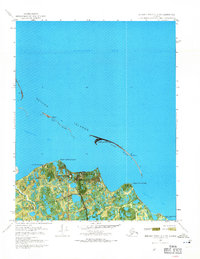
1970 Map of Beechey Point B-3 NW
USGS Topo · Published 1971About this map
Gwydyr Bay and the coastal fringes of the Beaufort Sea appear here at the dawn of the North Slope's industrial transformation. The landscape is defined by its transition from the tundra to the shallow waters of the Arctic, shielded by a string of barrier features including the Return Islands, Egg Island, and Stump Island. On the mainland, the map documents the early infrastructure of the oil era, specifically the North Prudhoe State 1 site and a Pumping Station. These industrial landmarks stand in contrast to older human footprints, such as Cabins (Ruins) near Point McIntyre. The presence of the Winter Trail and seasonal outposts like Kup Delta Camp highlights the specialized transportation and habitation required for this environment during the early 1970s. This orthophotomap combines aerial photography with topographic data to show the intricate network of thermokarst lakes and drainages surrounding Point Storkersen.
Find a feature on this map
19 named features on this map. Tap any name to fly to it.
Don’t see what you’re looking for? This feature index may not catch every label — zoom into the map to look around manually.
Map Details
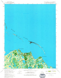
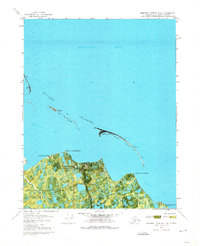
Editions of this 1970 Beechey Point B-3 NW Map
3 editions found
Other maps of this area

1951 · Beechey Point
USGS Topo · 1:250,000

1955 · Beechey Point
USGS Topo · 1:250,000
1955 · Beechey Point C-4
USGS Topo · 1:63,360

1955 · Beechey Point B-4
USGS Topo · 1:63,360

1955 · Beechey Point B-3
USGS Topo · 1:63,360

1960 · Beechey Point
USGS Topo · 1:250,000

1962 · Beechey Point B-4
USGS Topo · 1:50,000
1962 · Beechey Point C-4
USGS Topo · 1:50,000

1964 · Beechey Point
USGS Topo · 1:250,000
1970 · Beechey Point B-4 SE
USGS Topo · 1:24,000