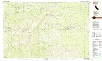
1981 Map of Beegum
USGS Topo · Published 1981About this map
Platina and the settlement of Beegum serve as the primary human outposts in this landscape defined by the intersection of three counties and two national forests. The map illustrates a remote territory where the Shasta National Forest and Trinity National Forest meet across complex terrain. Notable landmarks like Sugarloaf Mtn and Beegum Peak rise above the deep cut of the Beegum Gorge, while the presence of the Chrome Mine (Site) and various Prospects suggests the area's mineral interests. Life in this corner of the state is anchored by isolated family operations, including the Whiteman Ranch, Moore Ranch, and Foss Ranch. Federal oversight is visible through the Yolla Bolly District Ranger Station and Harrison Gulch Ranger Station, highlighting the area's role as a managed timber and watershed resource.
Find a feature on this map
75 named features on this map. Tap any name to fly to it.
Don’t see what you’re looking for? This feature index may not catch every label — zoom into the map to look around manually.
Map Details
Editions of this 1981 Beegum Map
This is the sole edition of this map. No revisions or reprints were ever made.
Other maps of this area

1890 · Red Bluff
USGS Topo · 1:250,000

1894 · Red Bluff
USGS Topo · 1:250,000

1931 · Hoaglin
USGS Topo · 1:96,000

1935 · Hoaglin
USGS Topo · 1:125,000

1949 · Colyear Springs
USGS Topo · 1:62,500

1951 · Chanchelulla Peak
USGS Topo · 1:62,500

1952 · Ono
USGS Topo · 1:62,500

1953 · Blackrock Mtn
USGS Topo · 1:62,500

1954 · Dubakella Mtn
USGS Topo · 1:62,500

1954 · Blackrock Mtn
USGS Topo · 1:62,500