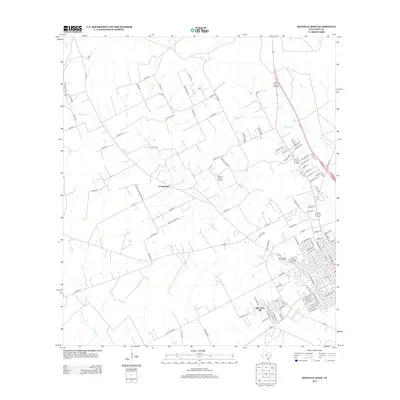
2013 Map of Beeville West
USGS Topo · Published 2013About this map
The community of Orangedale and the western outskirts of Beeville define this South Texas landscape in the early 21st century. The map illustrates a transitional zone where the grid of city streets gives way to larger landholdings and private ranches, such as the Private Algea Ranch Rd and Gill Ranch Rd. Regional hydrology is centered on the winding courses of Poesta Cr and Talpacate Cr, which provide the primary drainage for the area's brush country and agricultural fields.
Find a feature on this map
111 named features on this map. Tap any name to fly to it.
Don’t see what you’re looking for? This feature index may not catch every label — zoom into the map to look around manually.
Map Details
Editions of this 2013 Beeville West Map
This is the sole edition of this map. No revisions or reprints were ever made.
Other maps of this area

1936 · Pettus
USGS Topo · 1:62,500

1953 · Beeville
USGS Topo · 1:250,000

1954 · Skidmore
USGS Topo · 1:62,500

1954 · Fleming
USGS Topo · 1:62,500

1956 · Beeville
USGS Topo · 1:250,000

1956 · Pettus
USGS Topo · 1:62,500

1960 · Beeville
USGS Topo · 1:250,000
1963 · Tuleta
USGS Topo · 1:24,000
1963 · Mineral
USGS Topo · 1:24,000

1963 · Lazy F Ranch
USGS Topo · 1:24,000