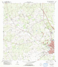
1979 Map of Beeville West
USGS Topo · Published 1979About this map
Beeville anchors the eastern edge of this late 1970s survey, where the town's residential grid meets the industrial and agricultural landscape of Bee County. The Southern Pacific railroad runs parallel to the town's core, connecting local institutions like the County College, Jones High Sch, and Our Lady of Victory Sch. The presence of Our Lady of Victory Cemetery and Cementerio Evangelico reflects the cultural history of this South Texas community.
Find a feature on this map
50 named features on this map. Tap any name to fly to it.
Don’t see what you’re looking for? This feature index may not catch every label — zoom into the map to look around manually.
Map Details
Editions of this 1979 Beeville West Map
This is the sole edition of this map. No revisions or reprints were ever made.
Other maps of this area

1936 · Pettus
USGS Topo · 1:62,500

1953 · Beeville
USGS Topo · 1:250,000

1954 · Skidmore
USGS Topo · 1:62,500

1954 · Fleming
USGS Topo · 1:62,500

1956 · Beeville
USGS Topo · 1:250,000

1956 · Pettus
USGS Topo · 1:62,500

1960 · Beeville
USGS Topo · 1:250,000
1963 · Tuleta
USGS Topo · 1:24,000
1963 · Mineral
USGS Topo · 1:24,000

1963 · Lazy F Ranch
USGS Topo · 1:24,000