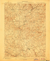
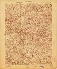
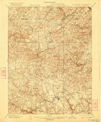
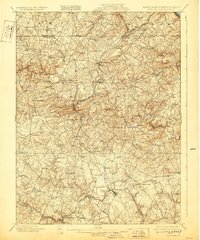
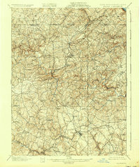
1901 Map of Belair
USGS Topo · Published 1906About this map
Deer Creek carves a winding path through the heart of the Maryland and Pennsylvania borderlands, anchoring a landscape of scattered rural hamlets and early industrial activity at the turn of the century. The northern edge of the sheet is defined by the Boundary Line, where the proximity of York and Harford counties fostered closely linked communities like Delta and Cardiff. This area is particularly notable for its extraction history, evidenced by the Mc Intyre Minefield and the concentrations of settlements like Slate Hill and West Bangor that supported local quarrying or mining operations.
Find a feature on this map
89 named features on this map. Tap any name to fly to it.
Don’t see what you’re looking for? This feature index may not catch every label — zoom into the map to look around manually.
Map Details
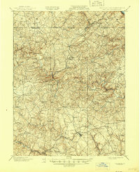
Editions of this 1901 Belair Map
7 editions found
Other maps of this area

1893 · Gunpowder
USGS Topo · 1:62,500

1894 · Baltimore
USGS Topo · 1:62,500

1898 · Tolchester
USGS Topo · 1:125,000

1899 · Baltimore
USGS Topo · 1:62,500

1900 · Havre De Grace
USGS Topo · 1:62,500

1900 · Betterton
USGS Topo · 1:62,500

1900 · Parkton
USGS Topo · 1:62,500

1901 · Belair
USGS Topo · 1:62,500

1901 · Gunpowder
USGS Topo · 1:62,500

1902 · Parkton
USGS Topo · 1:62,500