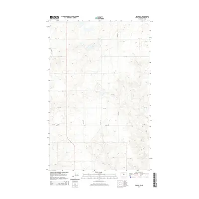
2014 Map of Belden SE
USGS Topo · Published 2014About this map
Finstad Cem stands as a quiet focal point in this portion of Mountrail County, serving as a primary landmark for local historians and genealogists. The landscape is defined by the rigid North Dakota section-line road grid, where east-west routes like 48th St NW and 43rd St NW intersect with north-south corridors such as 77th Ave NW and 81st Ave NW. This 2014 survey documents the contemporary rural infrastructure of the region, emphasizing the sparse, agricultural nature of the high plains. The lack of concentrated commercial development highlights the importance of family-named landmarks and local cemeteries in establishing the historical footprint of the community.
Find a feature on this map
11 named features on this map. Tap any name to fly to it.
Don’t see what you’re looking for? This feature index may not catch every label — zoom into the map to look around manually.
Map Details
Editions of this 2014 Belden SE Map
This is the sole edition of this map. No revisions or reprints were ever made.
Other maps of this area

1953 · Williston
USGS Topo · 1:250,000

1953 · Watford City
USGS Topo · 1:250,000

1957 · Williston
USGS Topo · 1:250,000

1957 · Watford City
USGS Topo · 1:250,000

1967 · Watford City
USGS Topo · 1:250,000

1981 · Belden SW
USGS Topo · 1:24,000

1981 · New Town
USGS Topo · 1:24,000
1981 · Belden SE
USGS Topo · 1:24,000
1981 · Parshall
USGS Topo · 1:24,000
1981 · Epworth
USGS Topo · 1:24,000