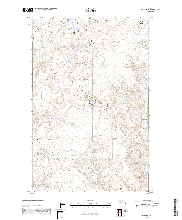
2024 Map of Belden SE
USGS Topo · Published 2024About this map
Belden Finnish Cemetery sits at the northern edge of this section of the North Dakota plains, a localized landmark within the township and range system that organizes the region. The landscape is characterized by a high density of wetlands and small water bodies scattered across the rolling prairie, a common feature of the Missouri Coteau. A network of rural section-line roads, including 49th St NW and 78th Ave NW, provides access to this sparsely populated agricultural area. Further south, Finstad Cemetery serves as another quiet marker of the area's early settlement history. The map's grid-like road system, with routes like 43rd St NW, reflects the enduring legacy of the Public Land Survey System in Mountrail County.
Find a feature on this map
19 named features on this map. Tap any name to fly to it.
Don’t see what you’re looking for? This feature index may not catch every label — zoom into the map to look around manually.
Map Details
Editions of this 2024 Belden SE Map
This is the sole edition of this map. No revisions or reprints were ever made.
Other maps of this area

1953 · Williston
USGS Topo · 1:250,000

1953 · Watford City
USGS Topo · 1:250,000

1957 · Williston
USGS Topo · 1:250,000

1957 · Watford City
USGS Topo · 1:250,000

1967 · Watford City
USGS Topo · 1:250,000

1981 · Belden SW
USGS Topo · 1:24,000

1981 · New Town
USGS Topo · 1:24,000
1981 · Belden SE
USGS Topo · 1:24,000
1981 · Parshall
USGS Topo · 1:24,000
1981 · Epworth
USGS Topo · 1:24,000