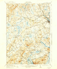
1917 Map of Belfast
USGS Topo · Published 1938About this map
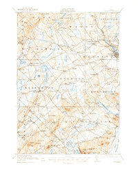
Belfast and its surrounding Waldo County townships were defined by a dense network of crossroad settlements and small-scale water-powered industries just after the turn of the century. The Passagassawakeag River serves as the primary artery, feeding into the harbor at the city center and powering operations such as Holmes Mill and Poors Mill. The arrival of the Maine Central Railroad at City Point and Head of the Tide illustrates the transit connections that linked this coastal region to broader Maine markets.
Find a feature on this map
139 named features on this map. Tap any name to fly to it.
Don’t see what you’re looking for? This feature index may not catch every label — zoom into the map to look around manually.
Map Details
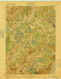
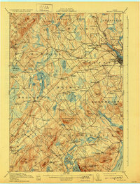
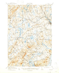
Editions of this 1917 Belfast Map
6 editions found

Other maps of this area

1900 · Bucksport
USGS Topo · 1:62,500

1902 · Bucksport
USGS Topo · 1:62,500

1902 · Castine
USGS Topo · 1:62,500

1904 · Castine
USGS Topo · 1:62,500

1904 · Vinalhaven
USGS Topo · 1:62,500

1904 · Rockland
USGS Topo · 1:62,500

1905 · Penobscot Bay
USGS Topo · 1:125,000

1906 · Rockland
USGS Topo · 1:62,500

1913 · Waldoboro
USGS Topo · 1:48,000

1915 · Waldoboro
USGS Topo · 1:62,500