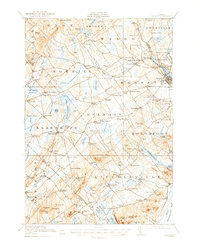
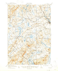
1917 Map of Belfast
USGS Topo · Published 1957About this map
The tidal waters of West Penobscot Bay meet the mouth of the Passagassawakeag R at the historic coastal hub of Belfast. This early twentieth-century survey reveals a landscape defined by an intricate network of rural corners and small industrial nodes, such as Head of the Tide and City Point, where the Central Maine RR facilitated commerce. Inland, the terrain rises toward significant heights like Moody Mountain and Levenseller Mountain, interspersed with a high density of local schools including Robinson School and Ghent School, serving the scattered townships of Northport, Searsmont, and Lincolnville. The abundance of namesake mills, such as Holmes Mill and Poors Mill, alongside geographic markers like Fosters Corner and Whitecombs Corner, provides a detailed record of the family-centered settlement patterns that shaped Waldo County during this era.
Find a feature on this map
181 named features on this map. Tap any name to fly to it.
Don’t see what you’re looking for? This feature index may not catch every label — zoom into the map to look around manually.
Map Details
Editions of this 1917 Belfast Map
6 editions found

Other maps of this area

1900 · Bucksport
USGS Topo · 1:62,500

1902 · Bucksport
USGS Topo · 1:62,500

1902 · Castine
USGS Topo · 1:62,500

1904 · Castine
USGS Topo · 1:62,500

1904 · Vinalhaven
USGS Topo · 1:62,500

1904 · Rockland
USGS Topo · 1:62,500

1905 · Penobscot Bay
USGS Topo · 1:125,000

1906 · Rockland
USGS Topo · 1:62,500

1913 · Waldoboro
USGS Topo · 1:48,000

1915 · Waldoboro
USGS Topo · 1:62,500