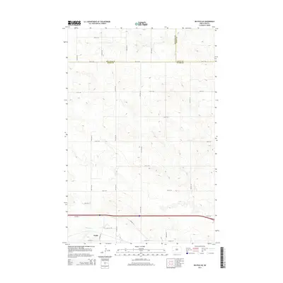
2014 Map of Belfield NE
USGS Topo · Published 2014About this map
Zenith anchors the southwestern corner of this landscape, situated near the headwaters of the Heart River as it begins its eastward journey. This 2014 survey captures a rural North Dakota expanse where three counties meet — Billings, Dunn, and Stark. The terrain is defined by a rigorous grid of section lines and gravel roads, such as 124th Ave Sw and 30th St Sw, which overlay the undulating drainage patterns of the N Cr. The presence of Highway 10 running parallel to the southern border reflects the enduring importance of east-west transport corridors in this part of the state, connecting the small settlement of Zenith to the broader regional network. The map reveals the intricate intersection of administrative boundaries and natural topography, providing a clear record of the area's land division and infrastructure.
Find a feature on this map
25 named features on this map. Tap any name to fly to it.
Don’t see what you’re looking for? This feature index may not catch every label — zoom into the map to look around manually.
Map Details
Editions of this 2014 Belfield NE Map
This is the sole edition of this map. No revisions or reprints were ever made.
Other maps of this area

1953 · Dickinson
USGS Topo · 1:250,000

1953 · Watford City
USGS Topo · 1:250,000

1957 · Dickinson
USGS Topo · 1:250,000

1957 · Watford City
USGS Topo · 1:250,000

1962 · Belfield NE
USGS Topo · 1:24,000

1962 · Belfield SW
USGS Topo · 1:24,000

1962 · Belfield
USGS Topo · 1:24,000

1962 · Belfield SE
USGS Topo · 1:24,000

1963 · Fairfield SE
USGS Topo · 1:24,000

1963 · Rattlesnake Butte
USGS Topo · 1:24,000