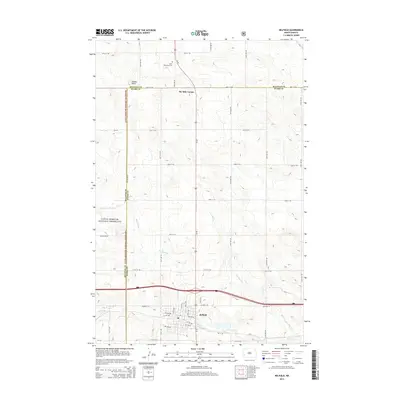
2014 Map of Belfield
USGS Topo · Published 2014About this map
Belfield sits at the southern edge of this western North Dakota landscape, serving as a hub where the Heart River and Coal Mine Cr converge. The terrain transitions from organized town blocks near Highway 10 to the open, topographic rises of the Little Missouri National Grassland along the western boundary. This survey captures a moment in the region's modern layout, showing the grid-based road system that connects rural landmarks like Six Mile Corner and the topographic high point of Saddle Butte. For those researching family history or local land use, the map identifies specific sites such as Saint Stanislaus Cem north of the town center. The network of section-line roads, including 30th St SW and 37th St SW, reveals the enduring structure of the Great Plains survey system as it integrates with the natural drainage of the Missouri River watershed.
Find a feature on this map
27 named features on this map. Tap any name to fly to it.
Don’t see what you’re looking for? This feature index may not catch every label — zoom into the map to look around manually.
Map Details
Editions of this 2014 Belfield Map
This is the sole edition of this map. No revisions or reprints were ever made.
Other maps of this area

1953 · Dickinson
USGS Topo · 1:250,000

1953 · Watford City
USGS Topo · 1:250,000

1957 · Dickinson
USGS Topo · 1:250,000

1957 · Watford City
USGS Topo · 1:250,000

1962 · Fryburg NE
USGS Topo · 1:24,000

1962 · Belfield NE
USGS Topo · 1:24,000

1962 · Belfield SW
USGS Topo · 1:24,000

1962 · Fryburg
USGS Topo · 1:24,000

1962 · Belfield
USGS Topo · 1:24,000

1962 · Belfield SE
USGS Topo · 1:24,000