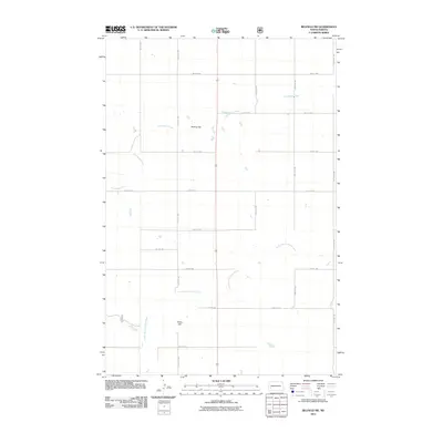
2011 Map of Belfield SW
USGS Topo · Published 2011About this map
The South Branch Heart River winds through this expanse of Stark County, defining a landscape of agricultural sections and vital water resources. In this part of North Dakota, the prairie terrain is punctuated by Rocky Hill and a systematic grid of section roads like 131st Ave SW and 43rd St SW. The hydrological profile of the area is further shaped by Norwegian Creek, which feeds toward Mesling Dam in the north-central portion of the quadrangle. This 2011 survey by the U.S. Geological Survey illustrates the enduring reliance on these waterways and the rigid township and range organization that still dictates the settlement pattern and land use in the region today.
Find a feature on this map
17 named features on this map. Tap any name to fly to it.
Don’t see what you’re looking for? This feature index may not catch every label — zoom into the map to look around manually.
Map Details
Editions of this 2011 Belfield SW Map
This is the sole edition of this map. No revisions or reprints were ever made.
Other maps of this area

1953 · Dickinson
USGS Topo · 1:250,000

1957 · Dickinson
USGS Topo · 1:250,000

1961 · Daglum
USGS Topo · 1:62,500

1961 · Rocky Ridge
USGS Topo · 1:62,500

1962 · Fryburg NE
USGS Topo · 1:24,000

1962 · Belfield NE
USGS Topo · 1:24,000

1962 · Belfield SW
USGS Topo · 1:24,000

1962 · Fryburg
USGS Topo · 1:24,000

1962 · Belfield
USGS Topo · 1:24,000

1962 · Belfield SE
USGS Topo · 1:24,000