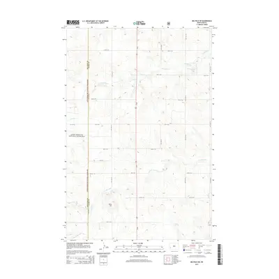
2014 Map of Belfield SW
USGS Topo · Published 2014About this map
The Little Missouri National Grassland dominates the western edge of this landscape, marking the transition into the protected prairie of the Badlands region. The terrain is defined by the high point of Rocky Hill and a network of drainages including Norwegian Cr and the S Br Heart River, which flow across the section lines of southern Stark County. A prominent natural water source, Black Spring, is situated near the southern boundary. This 2014 survey illustrates a rural grid of gravel roads and section lines, with Us-85 serving as the primary north-south artery through the territory. The map clearly delineates the Billings Co Stark Co boundary, showing how the administrative lines and land management divisions intersect with the natural topography of the western North Dakota plains.
Find a feature on this map
21 named features on this map. Tap any name to fly to it.
Don’t see what you’re looking for? This feature index may not catch every label — zoom into the map to look around manually.
Map Details
Editions of this 2014 Belfield SW Map
This is the sole edition of this map. No revisions or reprints were ever made.
Other maps of this area

1953 · Dickinson
USGS Topo · 1:250,000

1957 · Dickinson
USGS Topo · 1:250,000

1961 · Daglum
USGS Topo · 1:62,500

1961 · Rocky Ridge
USGS Topo · 1:62,500

1962 · Fryburg NE
USGS Topo · 1:24,000

1962 · Belfield NE
USGS Topo · 1:24,000

1962 · Belfield SW
USGS Topo · 1:24,000

1962 · Fryburg
USGS Topo · 1:24,000

1962 · Belfield
USGS Topo · 1:24,000

1962 · Belfield SE
USGS Topo · 1:24,000