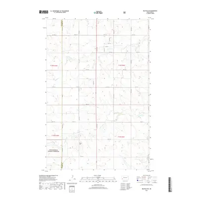
2017 Map of Belfield SW
USGS Topo · Published 2017About this map
Little Missouri National Grassland encompasses the southwestern portion of this Stark County landscape, where the high plains terrain is defined by dramatic elevation changes. The hydrology of the area is shaped by the S Br Heart River and its various tributaries, including the aptly named Norwegian Cr and Bull Cr. These watercourses carve through the topography, creating a series of draws and ridges that culminate at Rocky Hill. A network of section-line roads, such as Sully Creek Rd and numerous numbered streets, provides access to this sparsely settled ranching country. The presence of Black Spring near the southern boundary suggests a traditional water source in this semi-arid environment. This 2017 U.S. Geological Survey representation reflects the modern land management and township-and-range surveying that continues to govern this North Dakota badlands border region.
Find a feature on this map
18 named features on this map. Tap any name to fly to it.
Don’t see what you’re looking for? This feature index may not catch every label — zoom into the map to look around manually.
Map Details
Editions of this 2017 Belfield SW Map
This is the sole edition of this map. No revisions or reprints were ever made.
Other maps of this area

1953 · Dickinson
USGS Topo · 1:250,000

1957 · Dickinson
USGS Topo · 1:250,000

1961 · Daglum
USGS Topo · 1:62,500

1961 · Rocky Ridge
USGS Topo · 1:62,500

1962 · Fryburg NE
USGS Topo · 1:24,000

1962 · Belfield NE
USGS Topo · 1:24,000

1962 · Belfield SW
USGS Topo · 1:24,000

1962 · Fryburg
USGS Topo · 1:24,000

1962 · Belfield
USGS Topo · 1:24,000

1962 · Belfield SE
USGS Topo · 1:24,000